Anita Avenue
| Anita Avenue | |
|---|---|
| Neighborhood | Squirrel Hill South |
| Origin of name | Mildred Anita West |
| Zama Road (until 2003) | |
| Portion | Southwesternmost end |
| Origin of name | William Zama |
Anita Avenue was first laid out in 1926 in the Boulevard Park plan by J. A. West. This plan included only the part of Anita Avenue north of Fernwald Road. It also included a short street named Zama Road that intersected Fernwald Road to the southwest; today this is the southwesternmost part of Anita Avenue.[1][2]
Anita Avenue is named for West's daughter, Mildred Anita West (1911–1965), who later married W. S. Gearhart.[3][4][5][6]
Zama Road was named for William Zama, who owned property at the first curve in Fernwald Road north of Beechwood Boulevard.[1]
In 1927, the Park Edge Acres plan extended Zama Road to the east and north, around the easternmost curve of Fernwald Road, to Forward Avenue, though it did not connect to the portion of Zama Road that had been laid out in the Boulevard Park plan.[7][8]
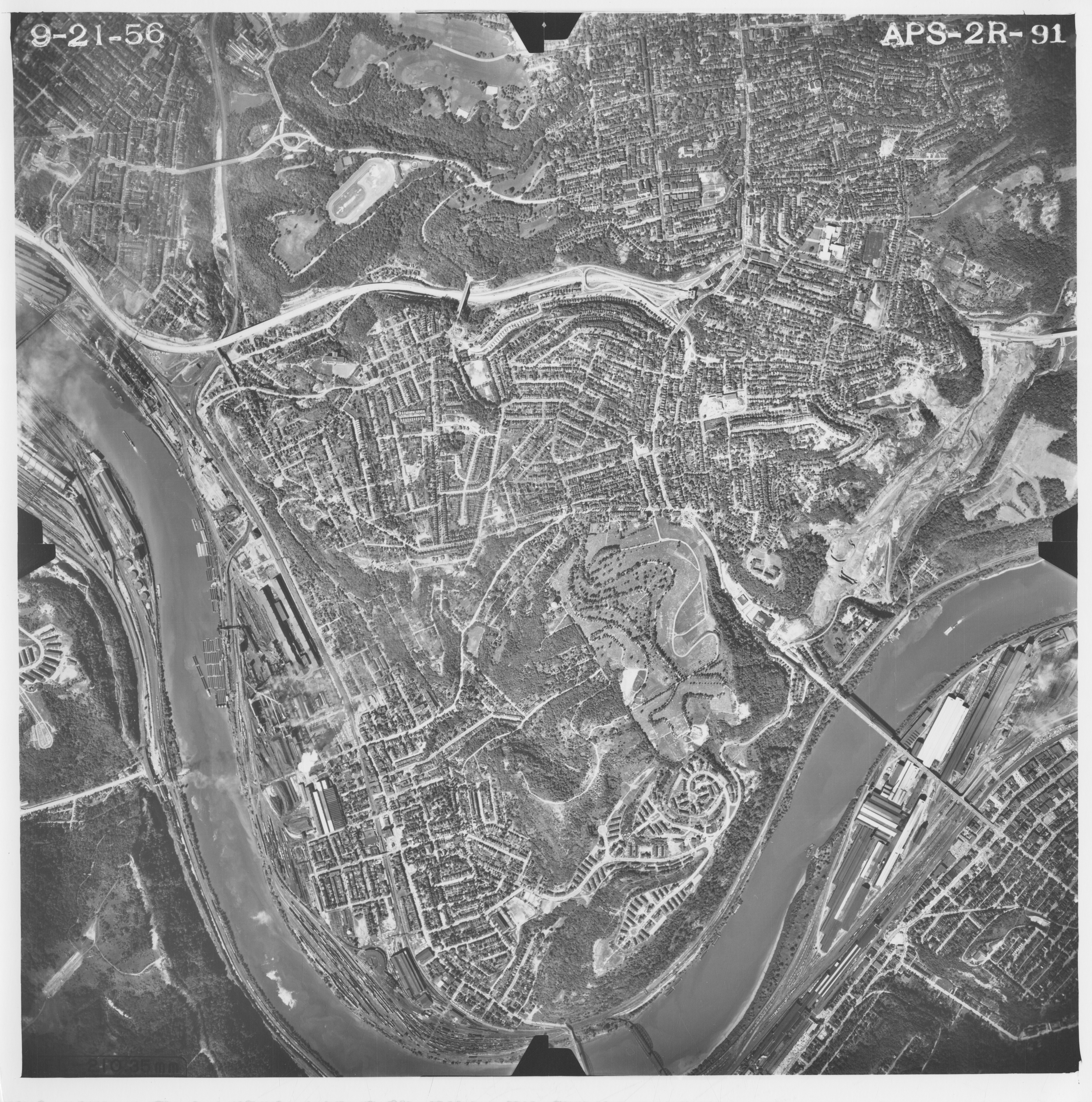
Anita Avenue was extended slightly south of Fernwald Road in the 1951 Boulevard Park plan no. 3, which also showed the southwestern end of Zama Road from the Park Edge Acres plan and included a "proposed Zama Road," indicating an intent to extend that road through the tract.[9] However, the 1953 Boulevard Park plan no. 4 instead extended Anita Avenue along a curve to the western edge of the plan.[10] This did not quite meet the original southwestern portion of Zama Road from the 1926 Boulevard Park plan, but the two were joined by 1956.[11][12]
The 1998–1999 Nine Mile Run plan no. 1, a predecessor of Summerset at Frick Park, included much of the land of the 1927 Park Edge Acres plan. The eastern part of Zama Road, laid out in the 1927 plan, was marked "to be vacated."[13] This was done by a resolution of City Council in 2001.[14]
In 2003, the College Development plan finally bridged the gap between the original southwestern part of Zama Road and the southern extension of Anita Avenue.[15] Zama Road officially became part of Anita Avenue by a resolution of City Council that year,[16] but in 2008 street signs still named the street Anita Avenue at one end and Zama Road at the other.[17]
References
- ↑ 1.0 1.1 "Boulevard Park plan: Laid out by Mr. J. A. West: Situate in Fourteenth Ward, Pittsburgh, Pa." Laid out Aug. 1926; recorded Mar. 15, 1927, Plan Book 32, pp. 82–85. Allegheny County Recorder of Deeds 3783891. [view source] boulevard-park-plan
- ↑ Real Estate Plat-Book of the City of Pittsburgh, vol. 2, pp. 28, 37. G. M. Hopkins & Co., Philadelphia, 1923. http://historicpittsburgh.org/maps-hopkins/1923-volume-2-plat-book-pittsburgh-east-end-south; included in the 1923 layer at PGH Historic Maps and Imagery (https://pittsburghpa.maps.arcgis.com/apps/instant/basic/index.html?appid=25ed595c7bde40cdae7165261a9a3ad6). [view source] hopkins-1923-2
- ↑ "J. A. West, realty man and builder." Obituaries. Pittsburgh Sun-Telegraph, Nov. 26, 1947, p. 19. Newspapers.com 524582648. [view source] james-a-west-obit-st
- ↑ Obituaries. Pittsburgh Post-Gazette, Nov. 27, 1947, p. 14. Newspapers.com 90081696. [view source] james-a-west-obit-pg
- ↑ Obituaries. Pittsburgh Press, Nov. 26, 1947, p. 17. Newspapers.com 149784055. [view source] james-a-west-obit-press
- ↑ "Mildred Anita West (1911–1965)." The Church of Jesus Christ of Latter-day Saints, FamilySearch, Feb. 2, 2025. https://familysearch.org/ark:/61903/4:1:GQ9L-3LG. [view source] fams-mildred-anita-west
- ↑ "Park Edge Acres plan of lots: Situate in the 14th Ward Pittsburgh, Pa.: Laid out by John E. Born, 1308 Peoples Bank Bldg. Pgh." Recorded May 25, 1927, Plan Book 32, pp. 91–95. [view source] park-edge-acres-plan
- ↑ Alexander Gross. Pittsburgh and Vicinity: Featuring transit lines and house numbers. Geographia Map Co. Inc., New York, 1953. Published with Alexander Gross, The Complete Street Guide to Pittsburgh and 16 Nearby Suburbs: With large map of Pittsburgh and suburbs; streets, house numbers, transportation lines, places of interest, churches, etc., etc., Geographia Map Co. Inc., New York, 1953 (DonsList.net PghStreets1953M). A slightly different version entitled The Premier Map of Pittsburgh and Vicinity is reproduced in Sam Stephenson, ed., Dream Street: W. Eugene Smith's Pittsburgh Project, pp. 22–23, University of Chicago Press, Chicago and London, 2023, ISBN 978-0-226-82483-3 (LCCN 2022055151). [view source] gross-map
- ↑ "Boulevard Park plan of lots no. 3: Allapenn Company: 14th Ward, City of Pittsburgh, Allegheny Co., Pa." Laid out Jan. 15, 1951; recorded Mar. 20, 1951, Plan Book 47, p. 95. Allegheny County Recorder of Deeds 3785498. [view source] boulevard-park-plan-3
- ↑ "Boulevard Park plan of lots no. 4: Sidney Goldstein & Lillian Goldstein; David N. Neustein & Gilda G. Neustein; Joseph Neustein & Ruthe Neustein: 14th Ward, City of Pittsburgh, Allegheny Co., Pa." Laid out Mar. 31, 1953; recorded May 21, 1954, Plan Book 53, pp. 105–106. Allegheny County Recorder of Deeds 3786246. [view source] boulevard-park-plan-4
- ↑ Aerial photograph APS-2R-91. 1956. https://www.pasda.psu.edu/pennpilot/era1960/allegheny_1956/allegheny_1956_photos_jpg_800/allegheny_092156_aps_2r_91.jpg; https://www.pasda.psu.edu/pennpilot/era1960/allegheny_1956/allegheny_1956_photos_tif/allegheny_092156_aps_2r_91.tif; included in the 1957 layer at PGH Historic Maps and Imagery (https://pittsburghpa.maps.arcgis.com/apps/instant/basic/index.html?appid=25ed595c7bde40cdae7165261a9a3ad6). [view source] squirrel-hill-aerial-1956
- ↑ Texaco. Pittsburgh and Vicinity. Rand McNally & Co., 1969. [view source] texaco-1969
- ↑ "Nine Mile Run plan no. 1: Prepared for the Urban Redevelopment Authority of Pittsburgh: Situate in 14th & 15th Wards, City of Pittsburgh, Allegheny County, Pa." Laid out Oct. 1998 and Apr. 21, 1999; recorded May 10, 1999, Plan Book 214, pp. 128–137. Allegheny County Recorder of Deeds 3504162. [view source] nine-mile-run-plan-1
- ↑ "Resolution vacating portions of Zama Road in the 14th Wards [sic], 5th Council District of the City of Pittsburgh." Pittsburgh city resolution, 2001, no. 533. Enacted July 24, 2001; effective July 31, 2001. https://pittsburgh.legistar.com/LegislationDetail.aspx?ID=632911&GUID=FD3A7DB7-5743-4042-95EE-B1F122BD7C24. [view source] resolution-2001-533
- ↑ "College Development plan of lots: Alan Dunn: 14th. Ward, City of Pittsburgh, Allegheny County, Pennsylvania." Laid out Apr. 21, 2003; recorded Sept. 11, 2003, Plan Book 243, p. 110. Allegheny County Recorder of Deeds 3959404. [view source] college-dev-plan
- ↑ "Resolution providing for an agreement or agreements by and between the City of Pittsburgh and College Development in connection with College Development's development and construction of certain dwellings on Zama Road, in the 14th Ward, and acceptance by the City of a deed from College Development to certain property on Zama Road, and authorizing the City to construct on said property a City street." Pittsburgh city resolution, 2003, no. 593. Enacted July 14, 2003; effective July 21, 2003. https://pittsburgh.legistar.com/LegislationDetail.aspx?ID=635470&GUID=7C98EDF5-D82F-4B00-A94F-31FD1BEEB5B8. [view source] resolution-2003-593
- ↑ Rich Lord. "City Council OKs rules for street names, numbers." Pittsburgh Post-Gazette, Oct. 16, 2008, p. B-3. Newspapers.com 96582369. [view source] lord
