Uncategorized files
From Pittsburgh Streets
Showing below up to 50 results in range #1 to #50.
-
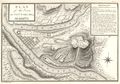
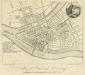
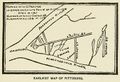 1761 Clapham map.jpg 1,344 × 922; 324 KB
-
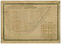
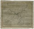
 1764 Campbell map.jpg 2,444 × 1,504; 385 KB
-
 1787 Hills map.jpg 14,128 × 7,816; 20.54 MB
-
 1788 Reserve Tract map.jpg 13,416 × 9,720; 30.61 MB
-
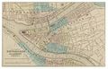
 1796 Collot map.jpg 3,350 × 2,350; 2.68 MB
-
 1815 Darby map.jpg 7,712 × 9,072; 25.25 MB
-
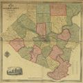
 1830 Barbeau and Keyon map.jpg 12,595 × 9,801; 21.47 MB
-
 1835 Keyon map.jpg 13,768 × 11,120; 35.8 MB
-
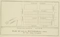
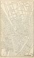
 1845 McGowin map.jpg 1,596 × 1,412; 678 KB
-
 1850 Heastings map.jpg 8,480 × 7,272; 14.65 MB
-
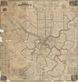
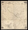
 1851 Sidney & Neff map.jpg 13,586 × 13,517; 52.14 MB
-
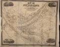
 1852 McGowin map.jpg 14,310 × 10,450; 30.09 MB
-
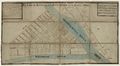
 1852 Phelps map.jpg 1,920 × 3,299; 4.36 MB
-
 1855 Colton map.jpg 4,687 × 3,013; 3.67 MB
-
 1856 McGowin map.jpg 14,760 × 9,992; 31.21 MB
-
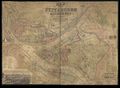
 1862 Beers map.jpg 17,850 × 18,815; 90.78 MB
-
 1862 Beers map (UWM).jpg 12,000 × 12,473; 26.98 MB
-
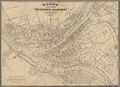
 1867 Iron City map.jpg 4,850 × 3,744; 6.62 MB
-
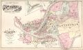
 1867 Woods map.jpg 9,027 × 6,524; 9.96 MB
-
 1872 Hopkins atlas, index map.jpg 11,384 × 6,952; 22.1 MB
-
 1876 Hopkins atlas, outline plan.jpg 7,498 × 5,120; 8.13 MB
-
 1882 Hopkins atlas, index map.jpg 10,944 × 7,232; 16.69 MB
-
 1883 Lee map.jpg 17,670 × 17,467; 82.87 MB
-
 1886 Hopkins atlas, index map.jpg 8,060 × 5,274; 10.08 MB
-
 1889 Hopkins atlas, vol. 1, index map.jpg 10,808 × 7,600; 19.27 MB
-
 1889 Hopkins atlas, vol. 2, index map.jpg 10,704 × 7,624; 21.71 MB
-
 1890 Hopkins atlas, Allegheny, vol. 1, index map.jpg 8,400 × 5,940; 9.17 MB
-
 1890 Hopkins atlas, Allegheny, vol. 2, index map.jpg 8,336 × 5,940; 10.36 MB
-
 1890 Hopkins atlas, vol. 3, index map.jpg 10,896 × 7,648; 20.11 MB
-
 1890 Hopkins atlas, vol. 4, index map.jpg 10,776 × 7,696; 21.84 MB
-
 1890 Hopkins atlas, vol. 5, index map.jpg 10,880 × 7,728; 18.79 MB
-
 1895 Diffenbacher map.png 8,939 × 6,556; 1.82 MB
-
 1895 Hopkins atlas, index map.jpg 5,464 × 8,664; 11.52 MB
-
 1895 Kelly map.jpg 15,168 × 11,216; 36.23 MB
-
 1896 Hopkins atlas, index map.jpg 5,280 × 8,896; 12.96 MB
-
 1897 Hopkins atlas, index map.jpg 5,368 × 8,728; 15.01 MB
-
 1898 Hopkins atlas, vol. 1, index map.jpg 11,384 × 9,008; 23.52 MB
-
 1899 Hopkins atlas, vol. 2, index map.jpg 11,304 × 8,960; 22.79 MB
-
 1900 Hopkins atlas, southeast, index map.jpg 8,456 × 6,810; 9.73 MB
-
 1900 Hopkins atlas, vol. 3, index map.jpg 11,160 × 8,864; 24.82 MB
-
 1901 Hopkins atlas, Allegheny, vol. 1, index map.jpg 8,300 × 6,581; 13.59 MB
-
 1901 Hopkins atlas, vol. 4, index map.jpg 11,344 × 8,992; 23.8 MB
-
 1902 Hopkins atlas, Allegheny, vol. 2, index map.jpg 8,500 × 6,832; 13.61 MB
-
 1903 Hopkins atlas, vol. 3, supplement, index map.jpg 8,576 × 6,750; 9.05 MB
-
 1904 Hopkins atlas, vol. 1, index map.jpg 9,536 × 6,840; 13.77 MB
-
 1904 Hopkins atlas, vol. 2, index map.jpg 9,536 × 6,840; 14.39 MB
-
 1905 Hopkins atlas, index map.jpg 4,740 × 6,840; 7.05 MB
-
 1906 Hopkins atlas, north, index map.jpg 9,448 × 6,810; 11.57 MB
-
 1906 Hopkins atlas, vol. 3, index map.jpg 9,416 × 6,720; 10.98 MB
-
 1907 Hopkins atlas, Allegheny, vol. 1, index map.jpg 12,192 × 8,784; 26.09 MB


.jpg)


