Source:Collot
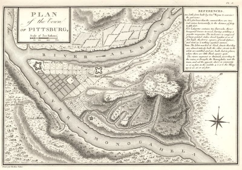
Victor Collot. Plan of the Town of Pittsburg. 1826. In Victor Collot, A Journey in North America: Containing a Survey of the Countries Watered by the Mississipi [sic], Ohio, Missouri, and Other Affluing Rivers; with Exact Observations on the Course and Soundings of These Rivers; and on the Towns, Villages, Hamlets and Farms of That Part of the New-World; Followed by Philosophical, Political, Military and Commercial Remarks and by a Projected Line of Frontiers and General Limits: Illustrated by 36 Maps, Plans, Views and Divers Cuts, vol. 2 (atlas), plate 6, Arthur Bertrand, Paris, 1826 (Historic Pittsburgh 31735061295659). http://www.davidrumsey.com/maps5639.html; 1796 layer at Pittsburgh Historic Maps (https://esriurl.com/pittsburgh). Reproduced in Stefan Lorant, Pittsburgh: The Story of an American City, 5th (Millennium) ed., p. 93, Esselmont Books, Pittsburgh, 1999, ISBN 0-967-41030-4 (LCCN 99-066641).

