File:Pittsburgh Streets logo.png
From Pittsburgh Streets
No higher resolution available.
Pittsburgh_Streets_logo.png (135 × 135 pixels, file size: 23 KB, MIME type: image/png)
Summary
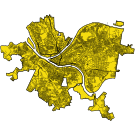
A map of Pittsburgh showing all of its current streets, made from City of Pittsburgh GIS data.
See also
File history
Click on a date/time to view the file as it appeared at that time.
| Date/Time | Thumbnail | Dimensions | User | Comment | |
|---|---|---|---|---|---|
| current | 01:40, 9 December 2024 | 135 × 135 (23 KB) | Bkell (talk | contribs) | cut out Williams Road through Reserve Township | |
| 01:06, 9 December 2024 | 135 × 135 (23 KB) | Bkell (talk | contribs) | a much more interesting logo: the streets of Pittsburgh, drawn from GIS data | ||
| 21:16, 30 October 2022 | 135 × 135 (4 KB) | Bkell (talk | contribs) | basic text logo for now |
You cannot overwrite this file.
File usage
There are no pages that use this file.
