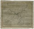
File:1850 Heastings map.jpg
From Pittsburgh Streets

Size of this preview: 699 × 599 pixels. Other resolutions: 2,388 × 2,048 pixels | 8,480 × 7,272 pixels.
Original file (8,480 × 7,272 pixels, file size: 14.65 MB, MIME type: image/jpeg)
Summary
E. H. Heastings. Map of the County of Allegheny, Pennsylvania. 1850. Historic Pittsburgh DARMAP0090. [view source] heastings
File history
Click on a date/time to view the file as it appeared at that time.
| Date/Time | Thumbnail | Dimensions | User | Comment | |
|---|---|---|---|---|---|
| current | 23:07, 19 October 2022 |  | 8,480 × 7,272 (14.65 MB) | Bkell (talk | contribs) | {{Source:Heastings}} |
You cannot overwrite this file.
File usage
The following 3 pages use this file: