File:1787 Hills map.jpg

Original file (14,128 × 7,816 pixels, file size: 20.54 MB, MIME type: image/jpeg)
Summary
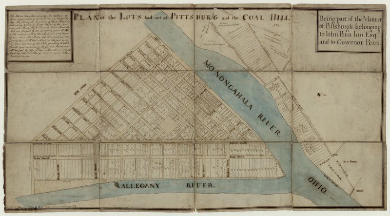
John Hills. Plan of the Lots Laid Out at Pittsburg and the Coal Hill. Philadelphia, 1787. Historic Pittsburgh DARMAP0464; LCCN 74692580. Reproduced in John W. Reps, The Making of Urban America: A history of city planning in the United States, p. 205, Princeton University Press, Princeton, N. J., 1965 (LCCN 63023414); in Stefan Lorant, Pittsburgh: The story of an American city, 5th (Millennium) ed., p. 53, Esselmont Books, Pittsburgh, 1999, ISBN 0-967-41030-4 (LCCN 99-066641); and in Emily M. Weaver, The Fort Pitt Block House, p. 40, History Press, Charleston, S. C., 2013, ISBN 978-1-60949-933-4. [view source] hills
File history
Click on a date/time to view the file as it appeared at that time.
| Date/Time | Thumbnail | Dimensions | User | Comment | |
|---|---|---|---|---|---|
| current | 05:21, 22 October 2022 |  | 14,128 × 7,816 (20.54 MB) | Bkell (talk | contribs) | {{Source:Hills}} |
You cannot overwrite this file.
File usage
The following 3 pages use this file: