File:Cook & Cassatt plan.tiff
From Pittsburgh Streets

Size of this JPG preview of this TIF file: 469 × 599 pixels. Other resolution: 1,603 × 2,048 pixels.

Original file (3,432 × 4,384 pixels, file size: 126 KB, MIME type: image/tiff, 2 pages)
Summary
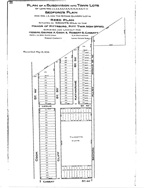
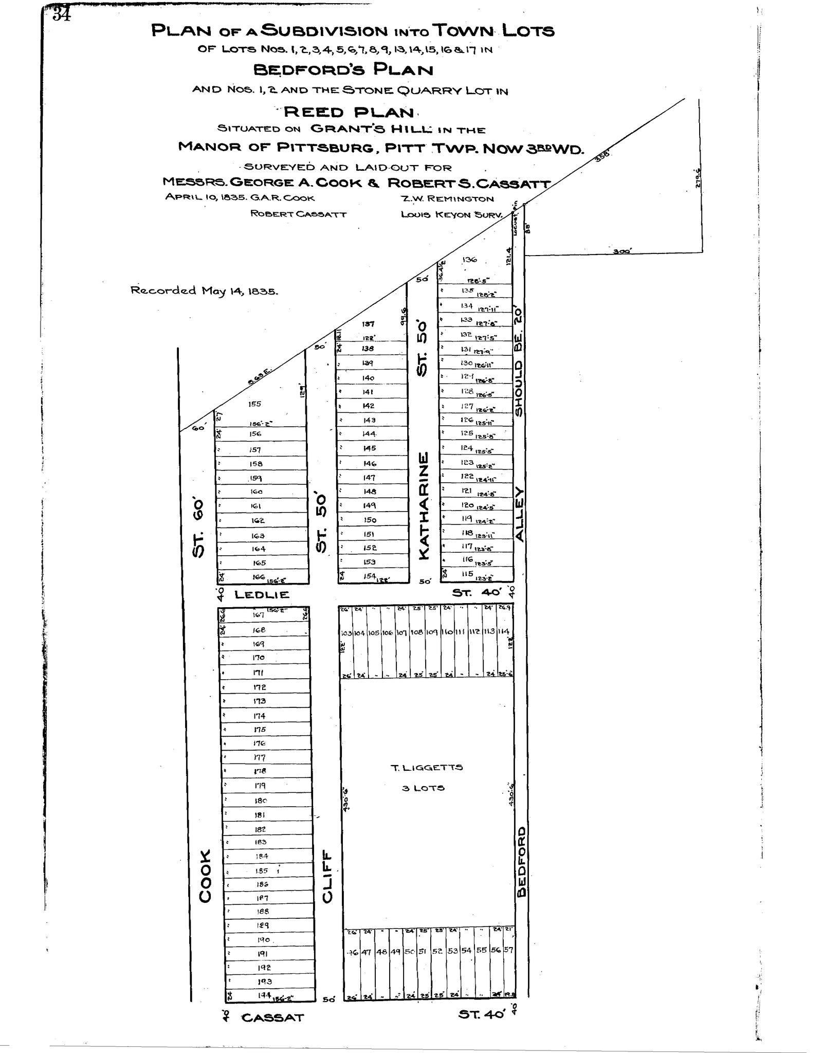
"Plan of a subdivision into town lots of lots nos. 1, 2, 3, 4, 5, 6, 7, 8, 9, 13, 14, 15, 16 & 17 in Bedford's plan and nos. 1, 2 and the stone quarry lot in Reed plan: Situated on Grant's Hill in the Manor of Pittsburg, Pitt Twp.: Surveyed and laid out for Messrs. George A. Cook & Robert S. Cassatt." Laid out Apr. 10, 1835; recorded May 14, 1835, Plan Book 1, p. 34. Allegheny County Recorder of Deeds 3778152. [view source] cook-cassatt-plan
File history
Click on a date/time to view the file as it appeared at that time.
| Date/Time | Thumbnail | Dimensions | User | Comment | |
|---|---|---|---|---|---|
| current | 14:01, 25 August 2025 |  | 3,432 × 4,384, 2 pages (126 KB) | Bkell (talk | contribs) | {{Source:Cook-cassatt-plan}} |
You cannot overwrite this file.
File usage
The following 2 pages use this file:
